August 1, 2020

Mantra Summits Challenge 2019 - 75K race report


Run Somewhere Extraordinary


TRAVEL DAY


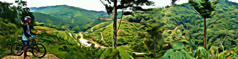
The race was staged in Malang, East Java of Indonesia. The journey took 3-hour flight from Kuala Lumpur to Surabaya with another 1+ hour van ride (depends on traffic) from Surabaya airport to the race venue, Kaliandra Eco Resort. I opted for the shuttle service provided by the race organizer from the airport to the race venue. Small additional fee to pay but saves you the headache trying to sort logistics on travel day. A welcoming service for runners flying from abroad.
I always travel one day before the race day if the travel time is short and reasonable.


RACE BIB COLLECTION


The shuttle dropped all runners at the race venue where you can straight away collect your race bib after showing all the mandatory items for the race. There were so many Malaysian runners who came down and it felt like I never left the country. Race bib collected, caught up with friends who I only see during races, carbo-loaded and finally checked-in to our homestay once it started to get dark.
By the way, have I mentioned that flag-off was the next day at 6:00 AM? Let’s try to get some sleep.

Satu kampung came down for this race!

photo credit: Pelari Denai

Bib number 147


RACE DAY


Quick recap on my training – I’d done Four Lakes 100K and Penang Eco 50K in Feb’19 and June’19 respectively, so I was pretty confident with my condition and training going into this race which was in Jul’19.

I signed up for 75K category because this was the longest category prior to 2019 before they introduced 116K category in 2019. Sticking to my rule I made up myself of one 100K race per year, my quota was full (with FL100). Thank God!


Starting line (KM 0): Kaliandra
Altitude: 763 m

It’s show time! Flag-off at 6:00 AM and it was climb, climb and more climb straight from the get-go. Who needs coffee when you can eat elevation for breakfast?


Aid station 1 (KM 9): Pondok Welirang
Altitude: 2,534 m
Elevation gain: +1,626 m
Elevation loss: -11 m
Moving time: 3:00:14

The first check point with cut-off time was at 11:00 AM. Only one runner didn’t make it in time, unfortunately it was our dear Abang Md Zin who was coming back from an injury.


Puncak Welirang (KM 13)
Altitude: 3,156 m
Elevation gain: +655 m
Elevation loss: -2 m
Elapsed time: 1:35:59

You cannot escape the strong smell of Sulphur during the climb-up of the peak of Welirang. There were several Sulphur deposits in this area. Hence, the summit was named Welirang meaning “sulphur” in Javanese.

High on Sulphur at Puncak Welirang


Aid station 2 (KM 16): Sadelan
Altitude: 2,908 m
Elevation gain: +88 m
Elevation loss: -302 m
Elapsed time: 0:43:18

I think this was the most crucial aid station in this race and you really need to refill for water here because the next one was in another 11KM but, this aid station had ran out of water supplies. Apparently runners for 116K category had already exhausted most of the water supplies after their early flag-off which shared the same route. Given the location of the aid station located on the ridge of Puncak Welirang and Puncak Arjuno, it was difficult and takes some time for the organizer to bring up the water here as the station was not accessible by vehicle. Many runners suffered dehydration as runners passed by this route during noon when the sun was high up.


Puncak Arjuno (KM20)
Altitude: 3,339 m
Elevation gain: +561 m
Elevation loss: -167 m
Elapsed time: 2:02:44

This was the highest point in the race. It took me 2 hours to reach here because I was cautiously managing the remaining water I had left and being high up at 3,000 m always make your move slower. This was not a water station like Puncak Welirang but a check point with a view. A damn good view if I may add!

Enroute to Puncak Arjuno from Sadelan

photo credit: MSC116

The peak of Arjuno was behind me but the checkpoint was cut short by 300 m

The best view comes after the hardest climb


Aid station 3 (KM 27): Budug Asu
Altitude: 1,316 m
Elevation gain: 32 m
Elevation loss: 1,969 m
Elapsed time:  2:10:37

It’s downhill all the way from Puncak Arjuno. Stunning view of the landscape everywhere you look. Special thanks to one group of local hikers who were super kind and spared me some of their water which I was really running low with. I would have struggled a lot to reach Budug Asu if it wasn’t for their help. Terima kasih Mas! 


Aid station 4 (KM 38): Wonorejo 1
Altitude: 944 m
Elevation gain: 209 m
Elevation loss: 546 m
Elapsed time:  1:39:22

The halfway mark. This was the aid station with our dropped bags and that means it’s time to chow down some rice. This was the longest rest stop I took which was half an hour of prepping the RTE food, refueling and just simply sat down and rest. The second half of the race was all during the night. Lights on baby!    


Mahapena (KM44)
Altitude: 2,127 m
Elevation gain: +1,190 m
Elevation loss: -15 m
Elapsed time:  2:35:09

The temperature quickly dropped at nightfall. This was an out-and-back trail to the peak of Bukit Mahapena. So I managed to see few front runners bombarding down from the peak.


Aid station 4 (KM 50): Wonorejo 2
Altitude: 944 m
Elevation gain: +1 m
Elevation loss: -1,185 m
Elapsed time:  1:36:08

Back to the same aid station where our dropped bags were. Many runners decided to call off their race here. Don’t hang around too long or you might have second thoughts to continue the race yourself.


Puthuk Lesung (KM62)
Altitude: 1,427 m
Elevation gain: +813 m
Elevation loss: -321 m
Elapsed time:  3:09:13

At this stage, I hardly saw any runners at the front nor at the back. As midnight falls, the streets became empty and the trails were much quieter. Almost 19+ hours in, I can feel sleep deprivation started to creep in. This was my least favorite part of ultra trail running because it was also the most dangerous part of ultra trail running.


Aid station 5 (KM 64): Mbah Kawad
Altitude: 1,213 m
Elevation gain: +211 m
Elevation loss: -422 m
Elapsed time:  2:04:06

My worst nightmare. This section was located on the side of a mountain slope. The next aid station was just 2KM from Puthuk Lesung but it took me 2 hours to reach there because I got lost.

First mistake: I lost track of the markers and I didn’t track back. A school boy error. In my mind, a marker should pop out anytime soon as further I went, but it didn’t.  

Second mistake: Given that it was an open mountain with low trees and shrubs and with the help of my GPS map watch, instead of tracking back, I went off trail trying to cut through to get back to the original trail.

This was where it went from bad to worse. The further I went, the bushes got thicker and the grass got higher. I couldn’t see what was in front of me. I didn’t even know the ground that I was stepping on was solid or not. I didn’t know how many times I lost my footing and tumbled over. I was scrambling through bushes and branches which made my socks and clothes wet. I even had to crawl on my knees and arms at one point. I shouted for help. I kept shouting “Tolong! Help! Someone help me!” over and over again. No reply. As I was cutting through, I reached a dead end, a cliff stood right in front of me. That moment felt like the end of life was staring back at me.

I was lost and alone at the bottom of a cliff on the side of a mountain in the dark at 3:00 AM. I stood there for a while to calm myself and gather my thoughts; pissed off with myself for not knowing better and gotten myself into this stupid and dangerous situation; thinking about my wife and family back home, praying to Allah seeking his help and protection; thinking about giving up and hoping that the rescue team would send a helicopter to pull me out.

Since it was still too early for any kind of help to come, and I had not suffered any injury, I picked myself up and kept going. I couldn’t climb over the cliff because it was too steep, so I went around it. I kept shouting for help until I heard a distant voice responded back (it’s a runner I hope). I headed towards the direction of the voice and didn’t follow my GPS navigation on my watch anymore. We were shouting back and forth so I could get a sense where they were until I finally saw a headlamp light. Then, I was back on a trail and regrouped with the runners, there were two of them.

Little that they knew, they had saved my life that day.

Section of the race where I got lost
 Give that guy a map
Where is he going?


Finish line (KM 75): Kaliandra
Altitude: 763 m
Elevation gain: +398 m
Elevation loss: -834 m
Elapsed time:  2:06:05

The time was almost 4:00 AM when I reached the last aid station at Mbah Kawad. Another 10K towards the finishing line with two hours left before the 24 hour COT. It’s going to be tight but I know I can make it. I knew I needed to run all the way and that was exactly what I did. I ran with what was left in my legs after 22 hours of running since I started the day before. I passed by runners who said we’re not going to make it in time. I finally reached Kaliandra Resort’s front gate entrance and one last climb along the side of the Kaliandra Resort which was very frustrating, then a downhill run before reaching the finishing line.

The saying goes “I can accept failures, but I cannot accept not trying”.

That day I’m glad I did.


Total time: 24:00:33
Total distance: 78.64 km
Total elevation gain: 5,789 m 
Total elevation loss: 5,786 m
Min elevation: 720 m
Max elevation: 3,265 m
Min temperature: 15 C
Max temperature: 33 C 
(Recorded on Garmin Forerunner 935)

75K category results
Registrants: 84
Starters: 73
DNS: 11
DNF: 46
Finishers: 27
Finisher rate: 37%

Crossing the finish line

photo credit: MSC116

The last finisher

photo credit: Heru Prabowo

July 23, 2019

Penang Eco 2019 - 50K race report


I needed a build-up race before Mantra Summit Challenge 75k (5,680m +/-) in July 2019. Penang Eco 50K was two weeks after Hari Raya and would be the perfect training block after one month of fasting in Ramadhan. So, it means that I have to forgo Raya open houses and one family trip for weekend trainings.


If I go down, I’m dragging someone with me! And that person is a newly turned dad and former high school buddy of mine, Hafizan, who has never ran a trail ultra-marathon, let alone a road marathon distance. I have been dragging him everywhere I go for training leading into the race day. This was also my first gig in a short 50K trail race and I went in with a mindset to race (as much racing there is for a mid-packer runner like me). I have goal for a 10 hour finish and then I will see where I stack among the finishers. The 50K route is the second half for 100K runners and the final third for 100 miles runners, where the huge junk of the elevation gain comes from for the race.      


RACE DAY


Hafizan is all smiles at the starting line of his first ultra marathon


Flag off was at 1:00 am. I like to run right in front of the middle pack to avoid bottleneck situation when I reach the first climb. Around 4:00 am after 14KM in, it started to pour as I went up the third climb into a durian orchard. Since it was durian season, there was no guarantee it was safe to run through the durian orchard during a thunderstorm. I can hear durians falling from the trees and hitting the ground.      


When I reached CP7-Berapit at KM20, the second check point for 50K runners, I saw Izuan sitting on a bench and had already retired from the race. He is usually a podium finisher for short races and this was his first attempt at a 50K race. Unfortunately, he decided to end his race early due to heavy rain which makes trekking through forest trails more difficult and dangerous. It was still pouring when I left CP7-Berapit and ran through housing areas, paddy fields and tarmac roads searching for orange spray paints of letter “E” on streetlight poles until I reached CP8-Temple at KM28. Isn’t this considered to be vandalism of public property?


It was already the break of dawn when I arrived at CP9-Tokun Dam at KM34. Tokun hill is a popular place to hike among the local hikers as I bumped into few on them on the trails and more at the trailhead of CP10-Tokun Hut at KM37. Finally, the sun came out to play around 10:00 am as I went past through the final CP11-Seraya Tinoga at KM46. I cannot tell how many times I needed to backtrack because I missed a marker. But, it’s always great to see runners working and communicating with each other to connect route between markers.


I was back at Sungai Lembu Chinese School and crossed the finish line around noon after 11 hours. 1 hour off from my target. They held the finisher ribbon out for every runner crossing the finish line which fooled me into thinking I had secured a top finish but only to be greeted with silence from the crowd and organiser.


Dear future organiser, finisher ribbons are for those who come in first place only. Ultra-runners are physically and mentally exhausted after running the whole day to have their feelings being played like that at the finish line. That is not cool!”


In case you are wondering about Hafizan, he crossed the finish line around 5:00 pm (COT 18 hours @ 7pm) in one piece but had a bad fall and sprained his ankle early at KM20 during a downhill section. He could have thrown in the towel looking at the state of his injury but he decided to finish the race with 30K remaining basically on one foot and dragging the other. Respect is given where it is due! And you earned it man!


Distance: 50.33 km
Elevation Gain: 2,841 m
Time: 11:02:10
(Recorded using Garmin Forerunner 935)


Crossing the finish line and blowing kisses (for no reason)


A swollen ankle the size of a tennis ball ain't stopping this guy from finishing.
Congrats bro! 


Great experience at PE100! Might run more shorter races in the future


16th overall


May 6, 2019

Four Lakes 2019 - 100K race report


"You know where the best paths lead to. Follow them."


Never thought I would run a 100k race so early in the year.  

I’ve been really taking it slow after my last race, TMBT in September 2018; spending time with the family and doing things outside of running (I just acquired my open water diving license!). Running is one of the things I like to do, but it’s not who I am.  For me, off-season is the time I would take a break from running so I can give my legs a chance to recover, work on strengthening my core and lower body flexibility. 

So, how did I stumble upon Four Lakes 100k (FL100)? Like all of us, when the year-end came, it was time to plan for a new year, a new season and a new adventure. I want to do a race before Ramadhan comes in May. Most 100k races in Malaysia are held in the second half of the year. Thus, I looked abroad for races in Hong Kong like 9 Dragons and Trans Lantau Ultra. Eventually, I had to set Hong Kong aside because it was not within my budget in that short span of time 

I heard Philippines have great trail ultras too and I have never been there before. I did my research on King of the Mountain Trail Run Philippines (KOTM) series which comprises five trail running events held in the vast Cordillera Mountain range in northern Philippines. All of the five events are held in the first half of the year starting with Mount Pack Ultra 50k in January and building up to the grand event of them all, Hardcore Hundred Miles in May. FL100 is one the events of the series held in February. Then, I came across a blog post about FL100 posted in 2016 by none other than Malaysia’s finest ultra-runner, Yim Heng Fatt at yimster.blogspot.com 

By this time, I already had my friend, Saufi who’s in for the ride and also will be running FL100. I read Yim’s post over and over again especially the logistic aspects. In 2016, Yim went with Zulfazli A.K.A Ultra Jol who I personally know, so I tracked Jol down into the wilderness forest where he would most likely to be at during the weekend and talked about his experience running FL100. 


Day 1Baguio 14/2/2019 (THU)  

Saufi and I took the midnight Cebu Pacific flight to Manila. After almost a 2-hour delay, we boarded the plane for a 4-hour flight. Once we had arrived at Manila International Airport, we took a bus from the airport to go to Pasay bus terminal, where we should catch an interstate bus, Victory Liner to Baguio (as per recommended by yim’s blog).  

However, we came off the bus a bit too soon at a different bus terminal from where we had intended to. There were no Victory Liner buses here but they have other bus operators like Genesis that still go to Baguio. Genesis offers standard and deluxe bus to Baguio (just like Victory Liner). For PHP730, the deluxe bus has more leg room, on board toilet, free Wi-Fi, blanket, snack and bottled water provided. The bus ride is about 5-6 hours with no stops. 

We decided to spend one night in Baguio to check out the bustling mountain town and make the journey to Kayapa town tomorrow morning. This is your last chance to get anything that you may have left out to bring for the race such as headlamp batteries, medicines and a hot cup of Starbucks. Weather in Baguio and Kayapa is like Genting Highlands for us here living in Kuala Lumpur, make sure you bring some extra layers. Brrr. 


With Saufi, our first crack at Four Lakes 100K.


List of food at every aid station.


Home away from home at Tessie's Guesthouse.


Day 3: Race day 16/2/2019 (SAT) 

There are only two distance categories, Four Lakes 100k and Old Spanish Trail 50k (OST50), both starts at the same time. Only 99 runners for FL100 (5 from Malaysia) and 42 runners for OST50 toed the line. Small numbers compared to Malaysia capitalist ultra-marathon scene that goes up to an average of 4 distance categories per event to accommodate different level of trail runners which takes out the allure of the main event, 100km or 100 miles. 

Aid station 1 (KM10)Bundao 
Elevation gain: 753 m 
Elevation loss: 61m 
Time: 1:30:57 

It’s show time! Countdown by the RD then off we went. My adrenaline rush got the best of me and I tried to run with the front pack. After 5 minutes in, I humbly settled into my pace. It was mostly uphill on the Talecabcab trail all the way to AS1. Nothing to see as it was still dark when I reached AS1. Timing is recorded manually by race marshals every time you come into an aid station. No timing chips, so no live tracking available.  


Before the start with fellow Malaysians.


Aid station 2 (KM24): Domolpos 
Elevation gain: 844 m 
Elevation loss: 941 m 
Time: 2:43:21 

Then we went down to Ansipsip as the sun breaks over the horizon slowly brightening the trails and landscapes. I was cruising down the descents when my foot caught a small rock caused me to fell forward to the ground. Luckily, it wasn’t serious and I only left with a small bruise on my left knee. Then we proceed with a climb to the summit of Mount Ugo (2,150 masl). The summit opened up into an empty clearing that was disappointingly surrounded by trees that block any views that we should have had. On my way down, I bumped into Saufi who just started to make his ascend to the summit from the Bacuyan Junction. That was the last time I saw him for the entire race. 


The view before reaching Mt. Ugo.


At the summit of Mt. Ugo.


Aid station 3 (KM35): Kayapa West 
Elevation gain: 77 m  
Elevation loss: 968 m 
Time: 1:27:01 

It was all downhill with runnable tracks heading into Kayapa West which was the lowest point of the course at 890 masl. I had been going for 6 hours and the hottest section of the course was up next under the afternoon heat. Runners at the aid station advised me to bring extra water. I already had 1 liter (500ml each) of softflask filled with water. I heeded their advice and took a third water bottle from my hydration vest and filled it with water. Every runner had to carry a minimum of 1.5 liter hydration capacity and it was one of the mandatory gears required for the race. 

Aid station 4/drop bag (KM52): Castillo 
Elevation gain: 1,055 m 
Elevation loss: 587 m 
Time: 3:45:46 

The climb plus the heat all the way to the telco tower was very long and physically demanding. I was running low on water after passing the telco tower. Then I saw a man struggling maneuvering his motorbike with a huge water container tied to the rear of his bike. The guy turned up to be a race crew who was assigned to bring water up for runners on this route. Once I reached Castillo aid station, I heated up my ready-to-eat Kembara food which I had in my drop bag for a full meal.  


Buaca Lake, the only existing lake out of the four lakes.
The rest have dried up and turned to grass field.


Aid station 5 (KM68): Banao 
Elevation gain: 1,139 m 
Elevation loss: 906 m 
Time: 4:36:56 

It was straight to work after leaving Castillo aid station with another climb to the summit where lakes which this race was named after were located. However, I only saw 1 lake (Buaca Lake) which would be hard for me to miss since it was the only one that was still filled with water. The other 3 lakes have all dried up and turned into grass field which I was told later. Route markers towards Talmoy village were not great. Ribbon markers were too far apart from the last marker point and they were not clearly visible especially at crossroads. Several times I had to track back which frustrated me. By the time I reached Banao aid station, it was already dark and the temperature quickly dropped.   


Remaining daylight after leaving Talmoy village.
Breathtaking!


Day 4: Race day 17/2/2019 (SUN) 

Aid station 6 (KM87): Dayap 
Elevation gain: 1,090 m 
Elevation loss: 1,025 m 
Time: 5:49:35 

Coming up next was the longest section (19k to the next and final aid station) of the race which took me well into the wee hours of the morning to complete. First, the long climb up Mount Pack to 2,177 masl (Mount Pack summit 2,284 masl) before the course shamefully cut us short of the trail leading towards the summit into a long technical mossy forest section. The mossy forest comes out at the back of Mount Pack then descend into an open downhill section before finally back on dirt roads. Trying to keep myself awake was the hardest part. There was no other runner for company.   I have been running by myself for the good half of the night. I made a point to take a snooze at the next aid station.       

Finish line (KM106): Kayapa Central School 
Elevation gain: 585 m 
Elevation loss: 1,050 m 
Time: 4:39:28 

When I left Dayap aid station, feeling somewhat fresh from my quick nap, I made a wrong turn down a concrete road to the right of the aid station which took me back about 400m.  I went down that far before turning back because the inconsistency placing of the route markers earlier in the course had me thinking that this was another bad marking from the organiser. This time I was dead wrong, off the course completely and had wasted any energy I had gained from my rest earlier. When back up the concrete road to the aid station, asked the race crew for direction and also gave them a piece of my mind. I can finally see the light at the end of the tunnel when I reached Indupit and back on the same Talecabcab trail that we had climbed up at the start of the race. Then there was the main road down to Kayapa Central School, the finish line and Saufi with Jonel waiting. It has taken me the entire night to complete the second half of the race. I finished just after the sunrise in 26 hours and 29 minutes. 


GPS track of me getting lost at the last aid station.


Alhamdulillah.
Hard earned finisher trophy of a warrior man made from wood by the locals. 


Total distance: 106 km 
Total elevation gain: 5,543 m 
Total elevation loss: 5,538 m 
Total time: 26:28:00 
Recorded using Garmin Forerunner 935 


OFFICIAL RESULTS: FOUR LAKES 100K  
Cut-off: 30:00:00 hours 
Rank: 35/72 
Time: 26:29:09 
Registrants: 102 
Starters: 99 
Did Not Start: 3 
Did Not Finish: 27 
Success Rate 2019: 72/99 = 73% * 
Success Rate 2018: 87/104 = 84% * 
Success Rate 2017: 147/192 = 77% 
Success Rate 2016: 128/133 = 96% 
Source: frontrunnermagph.com
* Updated route now includes the ascent to Mount Pack trailhead (2200 masl) via Cabayo.


Kit list**: 
Outdoor Research Sun Runner Cap 
Compressport headband 
Buff 
Goodr shades 
Salomon Trail Runner tee 
Outdoor Research Sun Sleeves 
Quechua NH100 Rain Jacket 
Instinct Evolution Trail Vest 7L 
Naked Running Band 
Salomon shorts 
T8 Commando running underwear 
Compressports R2V2 compression calf sleeves 
Injinji socks 
Salomon S-lab Sense Ultra 
Black Diamond Distance FLZ trekking poles 
** All items are paid for out of my own pocket